May 2, 2014

Wild flowers over the roofs of Port-Vendres in South of France

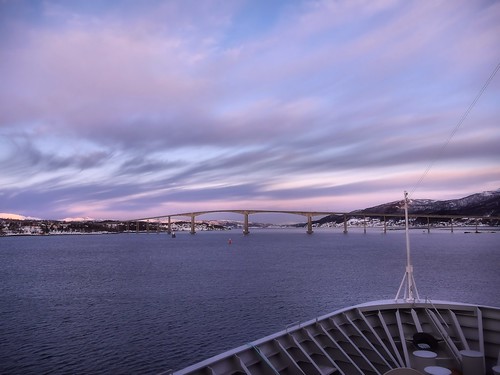
Now in May there is lots of wild flowers along the road we follows up in the hills above the small village Port-Vendres. The typical red roof bricks in South of France lays under us as we traverse the steep hill.
As here hiking up to Fort St. Elme a summit overlooking Cote Vermeille.


May 1, 2014

Beginning of the season in Collioure, South of France

In the season it is always filled up at the beaches in the center of the smal village Collioure in the South of France.
But here, in the beginning of May, we are in the beginning of the 2014 season and only some few people have found their way to the beach.
This is a stitch of 2 photos.

From the net
Situated in the very south of France, 26 km (approx. 15 miles) from the Spanish border, COLLIOURE is an idyllic place on the rocky coastline, nestling in an unspoilt, protected environment.
The small Catalan port is sheltered by a creek where the waters of the Mediterranean meet the rocks of the Pyrenees mountain chain.
An exceptionally sunny climate ensured by the Tramontana wind from the north makes COLLIOURE a unique place and a source of Catalan well-being and life style.
Several sandy or pebble beaches, creeks and clear waters provide opportunities for you to enjoy swimming.

April 30, 2014

Greetings from South of France....

Spring is a super time for grown people to spend in the very South of France. A bit off season - not to warm - perfect...
..and then those rental car agencies who promised you something like an Opel Corsa but then ends up with giving you this yellow color dot called Opel Adam - a car more for teenagers - asking me.... But why not...

April 23, 2014

Oslo Central Station - Covered. Oslo, Norway

Interesting effect and details from the front of the Central Station under reconstruction - behind the building coverage.

From the net:

Oslo S is Norway's busiest hub. In a few years is anticipated that as many as 100 million people will be visiting Oslo S during one year.

Oslo S is Norway's main hub and the largest and most important hub in the common Norway. Both now and in the future. While the station is fully operational, planning room a new Oslo S which will be by far the largest drive for both trains and all other public transport.

April 21, 2014

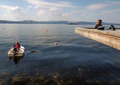
Boys & Boats - Easter day by the Oslofjord, Norway

We had a fine day at the Easter Day along the shores of Oslofjorden, (Nesodden) Norway.

After the winter some even had their first dip in the water even with no more than 9 deg Celcius out in the blue, while others was more engaged in looking at the passing boats and ships - as here when the colorline passes in the distant on way between Oslo and Kiel in Germany.

April 19, 2014

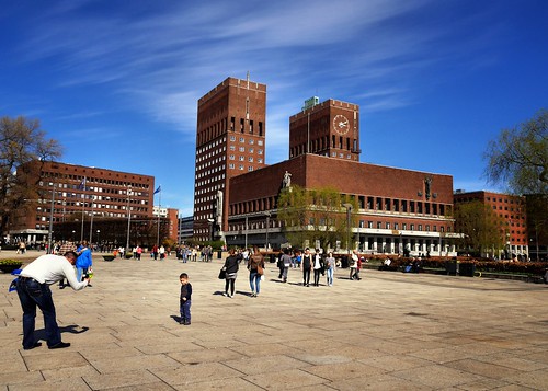
Norway, Oslo Town Hall - I was there at Holy Saturday

In Oslo today on the Holy Saturday. Lots of people strolling around in the city.

And of course have a souvenir photo in front of the Town Hall on the way to some ice cream on the popular Aker Brygge is just perfect at such a fine day....

April 18, 2014

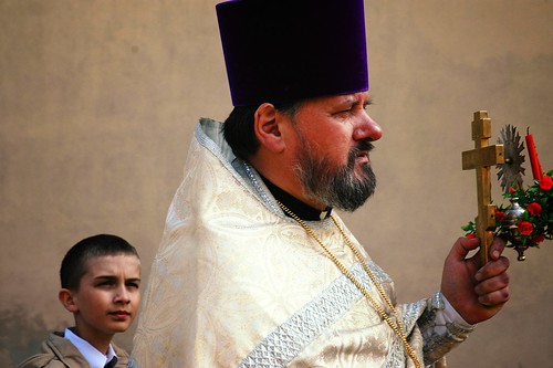
Poland, Podlaskie - One day to be like you....

"One day to be like you.."

Easter procession in an Orthodox Church in a village in the Podlaskie region of Poland.

Photo from some years back when visiting this interesting region with some photo friends.

April 17, 2014

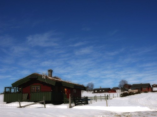
Norway - Valdres. Easter days with the last chance for cross country skiing


Mountains in altitude 800 meters or higher still have snow and ski tracks available. For many Norwegians the Easter days is their last chance for some days off now in the end of the winter season.

Presented here a small traditional mountain cottage in the popular low mountain region of Valdres (3hrs NorthWest of Oslo).
 

April 13, 2014

Norway Easter days in the Mountains


Last chance for some winter and snow holidays is in the Easter days in Norway. Many take some days off up in the mountains to enjoy i.e. Cross country skiing and spending some days in their mountain cottages.

This photo is from Golsfjellet and Valdres, alt. 850meters, where there still is just enough snow to use the cross country track (to be seen in the middle of the photo).

April 10, 2014

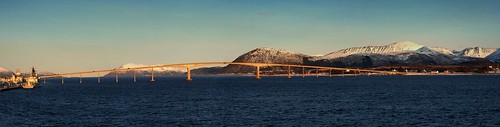
Norway Arctic, Stokmarknes - the Hadsel bridge / Hadselbroa


Tour Norway Arctic. Day 10 Stokmarknes

This photo is a stich of 4 photos shot from the deck of the coastal express MS Nordkapp. To the left some coast guard vessels at their naval base in Stokmarknes. To the right (hardly visible) the local airport. Klick the photo for a larger version..

From the net:
Hadsel Bridge ( Norwegian : Hadselbrua) is a cantilever road bridge on Norwegian County Road 82 that crosses the Langøysundet strait between the islands of Langøya and Børøya inNordland county, Norway . Together with the Børøy Bridge it connects the island of Hadseløya and the town of Stokmarknes to the neighboring island of Langøya .

Hadsel Bridge is 1,011 metres (3,317 ft) long, the main span is 150 metres (490 ft), and the maximum clearance to the sea is 30 metres (98 ft). The bridge has a total of 27 spans.

Hadsel Bridge was opened in 1978. It was one of 4 bridges that were built in the 1970s to connect the islands of Vesterålen to each other. The other bridges that were built during that period are Sortland Bridge , Andøy Bridge, and Kvalsaukan Bridge . Together with Tjeldsund Bridge near Harstad these bridges connect the islands of Vesterålen to the mainland.

Before the bridge was built, a ferry carried passengers across the sound between Sandnes on Langøya and the town of Stokmarknes on Hadseløya

April 5, 2014

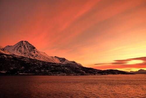
Last sunrise in Norway Arctic


Tour to Norway Arctic - Day 10, Sunrise South of Harstad

My tour lasted for 12 days. Todays photo is from day 10 on my way South with the coastal express - and the last morning with such a fantastic Arctic sunrise as late as 09.12AM.
The position is somewhere South of the Arctic town Harstad.

April 3, 2014

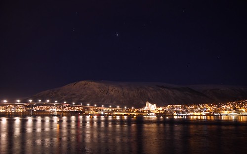
Norway Arctic - afternoon in Tromsø / Tromso

Tour to Norway Arctic. Day 09 Tromsø

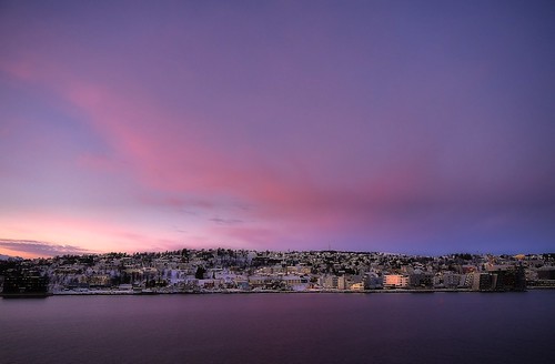
Probably the most remarkable with this photo from Tromsø is the time it was shot: 4.30PM in the afternoon. I think that should illustrate what we talk about when we call this time of the winter for a "dark time".

At day 09 of my travel I was going South with the coastal express, Hurtigruten, and had to wait in Tromsø until midnight before I could board the ship.

From wiki:

Tromsø is a city and municipality in Troms county, Norway.

It is the largest city and the largest urban area in Northern Norway, and the second largest city and urban area north of the Arctic Circle in Sápmi (following Murmansk).

Most of Tromsø, including the city centre, is located on the small island of Tromsøya in the county of Troms, 350 kilometres (217 mi) north of the Arctic Circle. Substantial parts of the urban area are also situated on the mainland to the east, and on parts of Kvaløya — a large island to the west.

Tromsøya is connected to the mainland by the Tromsø Bridge and the Tromsøysund Tunnel, and to the island of Kvaløya by the Sandnessund Bridge. The city is warmer than most other places located on the same latitude, due to the warming effect of the Gulf Stream.

The city centre of Tromsø contains the highest number of old wooden houses in Northern Norway, the oldest house dating from 1789.

The Arctic Cathedral, a modern church from 1965, is probably the most famous landmark in Tromsø.
April 1, 2014

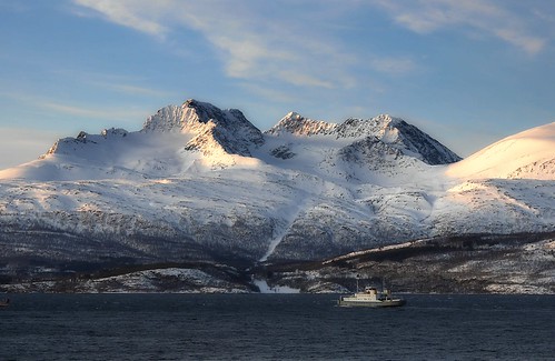
Norway Arctic: A car ferry in Lyngen, Troms

Tour to Norway Arctic. Day 08 - Lyngen in Troms

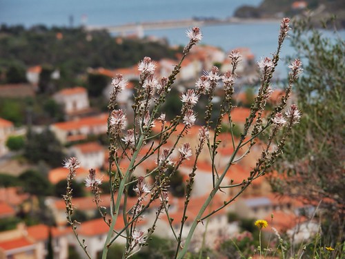
Selected photo for today a typical fjord landscape in Lyngen, Troms county, where a car ferry is out on her surely busy day.

Later in the day I will end up in the next largest city in the arctic region: Tromsø (BTW the largest city is Murmansk in Russia).

I will arrive around 4pm in Tromsø and have a very long wait before my southbound coastal steamer MS Nordkapp arrives at midnight.

Some info from Wiki:

The Lyngen Alps are a mountain range in northeastern Troms county in Norway, east of the city of Tromsø. The mountains dominate the Lyngen Peninsula, which is bordered by the Lyngen fjord to the east, and the Ullsfjorden to the west. The British climber William Cecil Slingsby was the first to climb many of the peaks

Lyngen was established as a municipality on 1 January 1838.

Lyngen have app. 2,225 residents.

During the Cold War the Norwegian Army planned to abandon Finnmark and halt the Soviets along the European route E6 highway at the choke point between the Lyngen fjord and the mountains. However, there were always great worries that the Soviets would also advance through Finland and the very sparsely defended extreme north of Sweden (north of Kiruna) and attack the Lyngen position from the rear via Signaldalen.
 

March 28, 2014

Norway - The North Cape Center


Norway tour to North Cape - Day 06, the north Cape Center.

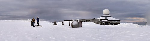
5 photos stitched.
 
In Norway visitors to the North Cape are in the thousands in the season, annually app. 250.000 visitors. But try to be there in a day in January - especially a day without any stop from the Hurtigruten (Coastal Express) in the nearby village Honningsvåg.
 
As it was this particular grey day in January. The daily car convoy, lead by a huge snow plow, consisted of only 4 cars and maybe 12 visitors that simply just disappeared in the huge North Cape Center or in outside activities. Illustrated here in a photo stitch of 5 photos from the North Cape Plateau with the people near the "Children of the World Sculpture", the big Hall in the center and the Arctic globe monument at far right.
 
The North Cape Hall
For several hundred years, the North Cape, which is located at 71°10'21, has attracted people from every corner of the globe. The globe monument erected in 1978 has become the actual symbol for the North Cape. At present, Nordkapphallen (North Cape Hall) is firmly ensconced on the massive cliff, 307 m above sea level, and marks the northernmost tip of Europe, representing the final frontier with the arctic sea.
Nordkapphallen (North Cape Hall) is open all year round and is a tourist centre for visitors to the North Cape. The centre offers a host of facilities.

March 27, 2014

Tour to Norway Arctic - Sjoegata / Sjøgata in Tromso / Tromsø

Tour to Norway Arctic. Day 04 Tromsø - Sjøgata

Sjøgata can be considered Tromsø's oldest street. It was built between Skansen and the church then lay a few hundred meters south of Prostneset. Along with Strand Street and Skippergata followed the shoreline, and is therefore not entitled as planned streets that Tromsø's main street today. Early in its history it was the main commercial street.

In this photo version I present a tilt-shift variant.

From wiki:

Tromsø is a city and municipality in Troms county, Norway.

It is the largest city and the largest urban area in Northern Norway, and the second largest city and urban area north of the Arctic Circle in Sápmi (following Murmansk).

Most of Tromsø, including the city centre, is located on the small island of Tromsøya in the county of Troms, 350 kilometres (217 mi) north of the Arctic Circle. Substantial parts of the urban area are also situated on the mainland to the east, and on parts of Kvaløya — a large island to the west.

Tromsøya is connected to the mainland by the Tromsø Bridge and the Tromsøysund Tunnel, and to the island of Kvaløya by the Sandnessund Bridge. The city is warmer than most other places located on the same latitude, due to the warming effect of the Gulf Stream.

The city centre of Tromsø contains the highest number of old wooden houses in Northern Norway, the oldest house dating from 1789.

The Arctic Cathedral, a modern church from 1965, is probably the most famous landmark in Tromsø.

March 24, 2014

Norway - the Arctic Cathedral


Tour to Norway Arctic. Day 04 Tromsø - The Arctic Cathedral

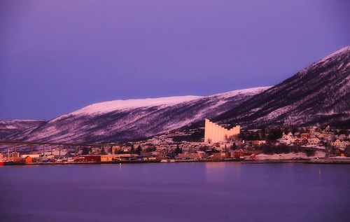
Over the bridge from the city to the community Tromsdalen we can see the distinct profile of Tromsdalen Church - mostly called The Arctic Cathedral. (Also this photo from my stop on the Northern bound coastal express). Photo from 14.14 in the afternoon.

Some more from wiki:
The Arctic Cathedral, formally known as Tromsdalen Church, is a church in the city of Tromsø in Troms county, Norway. The church is commonly nicknamed the Ishavskatedralen, literally "The Cathedral of the Arctic Sea" or "Arctic Cathedral". The church was built in 1965 in the Tromsdalen valley and it is a parish church and not, in fact, a cathedral as it is commonly called.

The church was designed by the architect Jan Inge Hovig and is built mainly of concrete.The church is probably the most famous landmark in Tromsø, although Tromsø does have another church of interest, Tromsø Cathedral, which is noted for being the only wooden cathedral in Norway.

March 21, 2014

Norway Arctic - Tromsø / Tromso Cathedral

 
Tour to Norway Arctic. Day 04 Tromsø Cathedral

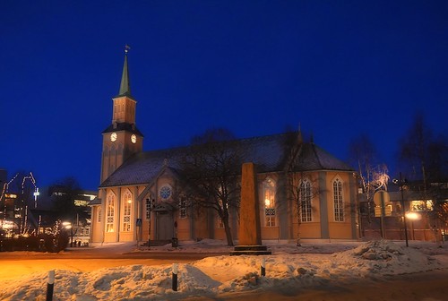
A big advantage being a photographer up North in the dark time of the winter is that you do not need to wait long to have the blue hour. Like here the clock is not yet 4PM and the blue hour is already present. This photo is of the fine wood church Tromsø Cathedral placed right in the center of the town.
 
Some more info from Wiki:
Tromsø Cathedral (Norwegian: Tromsø domkirke) is a cathedral in the city of Tromsø in Troms county, Norway. It is the episcopal seat of the Diocese of Nord-Hålogaland in the Church of Norway. This cathedral is notable since it is the only Norwegian cathedral made of wood.

The church is built in Gothic Revival style, with the church tower and main entrance on the west front. It is probably the northernmost Protestant cathedral in the world. With over 600 seats, it is one of Norway's biggest wooden churches. It originally held about 984 seats, but many benches and seats have been removed over the years to make room for tables in the back of the church.

The structure was completed in 1861. It was built using a cog joint method. It is situated in the middle of the city of Tromsø on a site where in all likelihood there has been a church since the 13th century
The first church in Tromsø was built in 1252 by King Haakon IV of Norway as a royal chapel.

The present cathedral was consecrated on 1 December 1861 by the Bishop Carl Peter Essendrop. In 1862 the bell tower was completed and the bell was installed. All of the interior decorations and art were not completed until the 1880s.
 

March 20, 2014

Norway Arctic - mainstreet Tromsø / Tromso


Tour to Norway arctic. Day 04 Tromsø

On this tour I visited Tromsø twice. First for a long stop on tour North with the MS Midnatsol and then waiting 8hrs. for the arrival of MS Nordkapp going south.
 
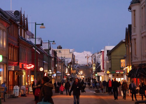
The photo of today was taken going north when I was walking around, as displayed here, in the busy main street. These days partly closed for cars to the benefit of the pedestrians.
 
You can see that the daylight is soon to end, already at 2.45PM. And people are warmly dressed even in just -5C degrees - but it was windy this day and by that it felt more like -10C...
 
From wiki:
Tromsø is a city and municipality in Troms county, Norway.

It is the largest city and the largest urban area in Northern Norway, and the second largest city and urban area north of the Arctic Circle in Sápmi (following Murmansk).

Most of Tromsø, including the city centre, is located on the small island of Tromsøya in the county of Troms, 350 kilometres (217 mi) north of the Arctic Circle. Substantial parts of the urban area are also situated on the mainland to the east, and on parts of Kvaløya — a large island to the west.

Tromsøya is connected to the mainland by the Tromsø Bridge and the Tromsøysund Tunnel, and to the island of Kvaløya by the Sandnessund Bridge. The city is warmer than most other places located on the same latitude, due to the warming effect of the Gulf Stream.

The city centre of Tromsø contains the highest number of old wooden houses in Northern Norway, the oldest house dating from 1789.

The Arctic Cathedral, a modern church from 1965, is probably the most famous landmark in Tromsø.
 

March 19, 2014

Norway, Tromso, arrival in a magic winter afternoon light

Tour to Norway North Cape. Day 04 Tromsø

On this tour I visited Tromsø twice. First for a long stop on the tour North with the MS Midnatsol where we arrived in the typical light of an early winter afternoon as displayed in this photo taken at 14.15 when sailing in the Tromsøsundet.

From wiki:

Tromsø is a city and municipality in Troms county, Norway.

It is the largest city and the largest urban area in Northern Norway, and the second largest city and urban area north of the Arctic Circle in Sápmi (following Murmansk).

Most of Tromsø, including the city centre, is located on the small island of Tromsøya in the county of Troms, 350 kilometres (217 mi) north of the Arctic Circle. Substantial parts of the urban area are also situated on the mainland to the east, and on parts of Kvaløya — a large island to the west.

Tromsøya is connected to the mainland by the Tromsø Bridge and the Tromsøysund Tunnel, and to the island of Kvaløya by the Sandnessund Bridge. The city is warmer than most other places located on the same latitude, due to the warming effect of the Gulf Stream.

The city centre of Tromsø contains the highest number of old wooden houses in Northern Norway, the oldest house dating from 1789.

The Arctic Cathedral, a modern church from 1965, is probably the most famous landmark in Tromsø.
 

March 18, 2014

Norway, Senja - Magical Arctic Light

Norway Arctic. Day 04 - The Magical Arctic light

That afternoon at 11.45 AM we departed the village Finnsnes on our way north. Right ahead of the ship we see the grand bridge from the mainland and over to the island Senja. And then: What a magic light - already at this time of the day in late January the sunset is making it's magic in the lightly clouded sky (of course some minor adjustment of contrast and color adjustments expose the light even better in the presented result (but no HDR or exaggerated adjustments)).

Our screens looks often different - Still study the strange light apparently in the clouds in the left part (under the big cloud). Regard the strange colors - not red, not blue but maybe in the direction of green. Is it possible that we have a very early glimpse of the coming Northern Light? (that later in the evening was quite strong this day). I don't know.

Anyway this journey was for me a total surprise with days that I within a few hrs had those stunning sunrises and sunsets.

From the net:

Gisund Bridge is a cantilever road bridge on Norwegian County Road 86 in Troms county, Norway.

The bridge crosses the Gisundet strait from the town of Finnsnes on the mainland to the village of Silsand on the island of Senja.

The 1,147-metre (3,763 ft) long bridge has 25 spans, the main span being 143 metres (469 ft) long. The maximum clearance to the sea below the bridge is 41 metres (135 ft). Gisund Bridge was opened on 23 June 1972.

Senja - Norways second largest island

Senja (Northern Sami: Sážžá) is the second largest island in Norway (not counting Svalbard).

Norwegian musician Moddi comes from the island and his music has been said to have been influenced by the beauty of the island.

Senja is located along the Troms county coastline with Finnsnes as the closest town. The municipalities located on Senja are Lenvik (part of which is on the mainland), Berg, Torsken, and Tranøy. Senja had 7782 inhabitants as of 1 January 2008.

The north and western coasts of Senja are facing the open sea. Here, steep and rugged mountains rise straight from the sea, with some fishing villages (like Gryllefjord, Husøy) wherever there is some lowland. The eastern and southern parts of the island are milder, with rounder mountains, forests, rivers and agriculture land.