March 28, 2014

Norway - The North Cape Center


Norway tour to North Cape - Day 06, the north Cape Center.

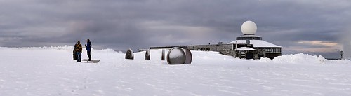
5 photos stitched.
 
In Norway visitors to the North Cape are in the thousands in the season, annually app. 250.000 visitors. But try to be there in a day in January - especially a day without any stop from the Hurtigruten (Coastal Express) in the nearby village Honningsvåg.
 
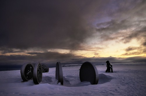
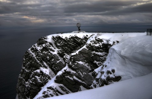
As it was this particular grey day in January. The daily car convoy, lead by a huge snow plow, consisted of only 4 cars and maybe 12 visitors that simply just disappeared in the huge North Cape Center or in outside activities. Illustrated here in a photo stitch of 5 photos from the North Cape Plateau with the people near the "Children of the World Sculpture", the big Hall in the center and the Arctic globe monument at far right.
 
The North Cape Hall
For several hundred years, the North Cape, which is located at 71°10'21, has attracted people from every corner of the globe. The globe monument erected in 1978 has become the actual symbol for the North Cape. At present, Nordkapphallen (North Cape Hall) is firmly ensconced on the massive cliff, 307 m above sea level, and marks the northernmost tip of Europe, representing the final frontier with the arctic sea.
Nordkapphallen (North Cape Hall) is open all year round and is a tourist centre for visitors to the North Cape. The centre offers a host of facilities.

March 27, 2014

Tour to Norway Arctic - Sjoegata / Sjøgata in Tromso / Tromsø

Tour to Norway Arctic. Day 04 Tromsø - Sjøgata

Sjøgata can be considered Tromsø's oldest street. It was built between Skansen and the church then lay a few hundred meters south of Prostneset. Along with Strand Street and Skippergata followed the shoreline, and is therefore not entitled as planned streets that Tromsø's main street today. Early in its history it was the main commercial street.

In this photo version I present a tilt-shift variant.

From wiki:

Tromsø is a city and municipality in Troms county, Norway.

It is the largest city and the largest urban area in Northern Norway, and the second largest city and urban area north of the Arctic Circle in Sápmi (following Murmansk).

Most of Tromsø, including the city centre, is located on the small island of Tromsøya in the county of Troms, 350 kilometres (217 mi) north of the Arctic Circle. Substantial parts of the urban area are also situated on the mainland to the east, and on parts of Kvaløya — a large island to the west.

Tromsøya is connected to the mainland by the Tromsø Bridge and the Tromsøysund Tunnel, and to the island of Kvaløya by the Sandnessund Bridge. The city is warmer than most other places located on the same latitude, due to the warming effect of the Gulf Stream.

The city centre of Tromsø contains the highest number of old wooden houses in Northern Norway, the oldest house dating from 1789.

The Arctic Cathedral, a modern church from 1965, is probably the most famous landmark in Tromsø.

March 24, 2014

Norway - the Arctic Cathedral


Tour to Norway Arctic. Day 04 Tromsø - The Arctic Cathedral

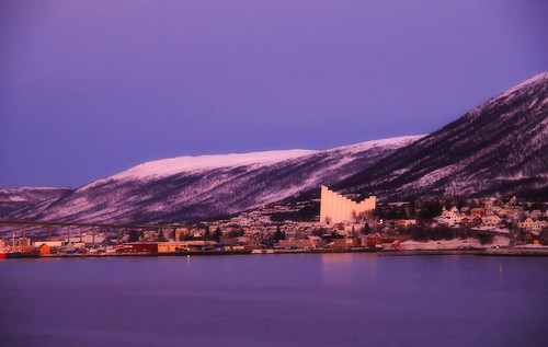
Over the bridge from the city to the community Tromsdalen we can see the distinct profile of Tromsdalen Church - mostly called The Arctic Cathedral. (Also this photo from my stop on the Northern bound coastal express). Photo from 14.14 in the afternoon.

Some more from wiki:
The Arctic Cathedral, formally known as Tromsdalen Church, is a church in the city of Tromsø in Troms county, Norway. The church is commonly nicknamed the Ishavskatedralen, literally "The Cathedral of the Arctic Sea" or "Arctic Cathedral". The church was built in 1965 in the Tromsdalen valley and it is a parish church and not, in fact, a cathedral as it is commonly called.

The church was designed by the architect Jan Inge Hovig and is built mainly of concrete.The church is probably the most famous landmark in Tromsø, although Tromsø does have another church of interest, Tromsø Cathedral, which is noted for being the only wooden cathedral in Norway.

March 21, 2014

Norway Arctic - Tromsø / Tromso Cathedral

 
Tour to Norway Arctic. Day 04 Tromsø Cathedral

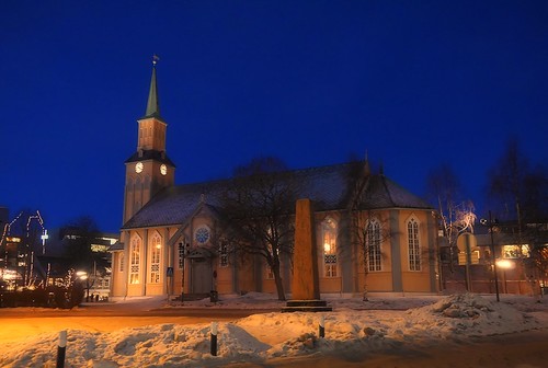
A big advantage being a photographer up North in the dark time of the winter is that you do not need to wait long to have the blue hour. Like here the clock is not yet 4PM and the blue hour is already present. This photo is of the fine wood church Tromsø Cathedral placed right in the center of the town.
 
Some more info from Wiki:
Tromsø Cathedral (Norwegian: Tromsø domkirke) is a cathedral in the city of Tromsø in Troms county, Norway. It is the episcopal seat of the Diocese of Nord-Hålogaland in the Church of Norway. This cathedral is notable since it is the only Norwegian cathedral made of wood.

The church is built in Gothic Revival style, with the church tower and main entrance on the west front. It is probably the northernmost Protestant cathedral in the world. With over 600 seats, it is one of Norway's biggest wooden churches. It originally held about 984 seats, but many benches and seats have been removed over the years to make room for tables in the back of the church.

The structure was completed in 1861. It was built using a cog joint method. It is situated in the middle of the city of Tromsø on a site where in all likelihood there has been a church since the 13th century
The first church in Tromsø was built in 1252 by King Haakon IV of Norway as a royal chapel.

The present cathedral was consecrated on 1 December 1861 by the Bishop Carl Peter Essendrop. In 1862 the bell tower was completed and the bell was installed. All of the interior decorations and art were not completed until the 1880s.
 

March 20, 2014

Norway Arctic - mainstreet Tromsø / Tromso


Tour to Norway arctic. Day 04 Tromsø

On this tour I visited Tromsø twice. First for a long stop on tour North with the MS Midnatsol and then waiting 8hrs. for the arrival of MS Nordkapp going south.
 
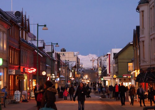
The photo of today was taken going north when I was walking around, as displayed here, in the busy main street. These days partly closed for cars to the benefit of the pedestrians.
 
You can see that the daylight is soon to end, already at 2.45PM. And people are warmly dressed even in just -5C degrees - but it was windy this day and by that it felt more like -10C...
 
From wiki:
Tromsø is a city and municipality in Troms county, Norway.

It is the largest city and the largest urban area in Northern Norway, and the second largest city and urban area north of the Arctic Circle in Sápmi (following Murmansk).

Most of Tromsø, including the city centre, is located on the small island of Tromsøya in the county of Troms, 350 kilometres (217 mi) north of the Arctic Circle. Substantial parts of the urban area are also situated on the mainland to the east, and on parts of Kvaløya — a large island to the west.

Tromsøya is connected to the mainland by the Tromsø Bridge and the Tromsøysund Tunnel, and to the island of Kvaløya by the Sandnessund Bridge. The city is warmer than most other places located on the same latitude, due to the warming effect of the Gulf Stream.

The city centre of Tromsø contains the highest number of old wooden houses in Northern Norway, the oldest house dating from 1789.

The Arctic Cathedral, a modern church from 1965, is probably the most famous landmark in Tromsø.
 

March 19, 2014

Norway, Tromso, arrival in a magic winter afternoon light

Tour to Norway North Cape. Day 04 Tromsø

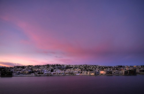
On this tour I visited Tromsø twice. First for a long stop on the tour North with the MS Midnatsol where we arrived in the typical light of an early winter afternoon as displayed in this photo taken at 14.15 when sailing in the Tromsøsundet.

From wiki:

Tromsø is a city and municipality in Troms county, Norway.

It is the largest city and the largest urban area in Northern Norway, and the second largest city and urban area north of the Arctic Circle in Sápmi (following Murmansk).

Most of Tromsø, including the city centre, is located on the small island of Tromsøya in the county of Troms, 350 kilometres (217 mi) north of the Arctic Circle. Substantial parts of the urban area are also situated on the mainland to the east, and on parts of Kvaløya — a large island to the west.

Tromsøya is connected to the mainland by the Tromsø Bridge and the Tromsøysund Tunnel, and to the island of Kvaløya by the Sandnessund Bridge. The city is warmer than most other places located on the same latitude, due to the warming effect of the Gulf Stream.

The city centre of Tromsø contains the highest number of old wooden houses in Northern Norway, the oldest house dating from 1789.

The Arctic Cathedral, a modern church from 1965, is probably the most famous landmark in Tromsø.
 

March 18, 2014

Norway, Senja - Magical Arctic Light

Norway Arctic. Day 04 - The Magical Arctic light

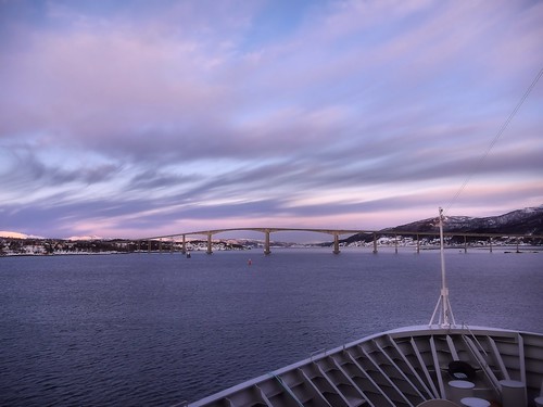
That afternoon at 11.45 AM we departed the village Finnsnes on our way north. Right ahead of the ship we see the grand bridge from the mainland and over to the island Senja. And then: What a magic light - already at this time of the day in late January the sunset is making it's magic in the lightly clouded sky (of course some minor adjustment of contrast and color adjustments expose the light even better in the presented result (but no HDR or exaggerated adjustments)).

Our screens looks often different - Still study the strange light apparently in the clouds in the left part (under the big cloud). Regard the strange colors - not red, not blue but maybe in the direction of green. Is it possible that we have a very early glimpse of the coming Northern Light? (that later in the evening was quite strong this day). I don't know.

Anyway this journey was for me a total surprise with days that I within a few hrs had those stunning sunrises and sunsets.

From the net:

Gisund Bridge is a cantilever road bridge on Norwegian County Road 86 in Troms county, Norway.

The bridge crosses the Gisundet strait from the town of Finnsnes on the mainland to the village of Silsand on the island of Senja.

The 1,147-metre (3,763 ft) long bridge has 25 spans, the main span being 143 metres (469 ft) long. The maximum clearance to the sea below the bridge is 41 metres (135 ft). Gisund Bridge was opened on 23 June 1972.

Senja - Norways second largest island

Senja (Northern Sami: Sážžá) is the second largest island in Norway (not counting Svalbard).

Norwegian musician Moddi comes from the island and his music has been said to have been influenced by the beauty of the island.

Senja is located along the Troms county coastline with Finnsnes as the closest town. The municipalities located on Senja are Lenvik (part of which is on the mainland), Berg, Torsken, and Tranøy. Senja had 7782 inhabitants as of 1 January 2008.

The north and western coasts of Senja are facing the open sea. Here, steep and rugged mountains rise straight from the sea, with some fishing villages (like Gryllefjord, Husøy) wherever there is some lowland. The eastern and southern parts of the island are milder, with rounder mountains, forests, rivers and agriculture land.

March 16, 2014

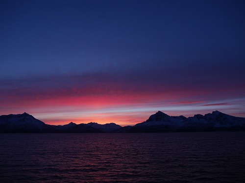
Good morning from Norway Arctic

Tour to Norway, North Cape. Day 04. Arctic morning

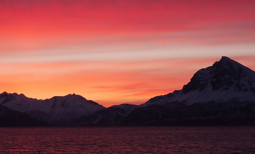
This photo is taken 9.26AM at sunrise, Jan, 22. 2014. Focal lenght 45mm (90mm). According to my sailing plan with the coastal express we was at that time app. at 68 degrees North (a bit north of Harstad) which we departed 8.00AM).

There is another photo taken in the same minute with focal length 14mm (28mm) that presents quite a different color set for this sunrise. Have a look at:

www.flickr.com/photos/jrjohanson/12716260883

What to say for two photos taken in the same minute, with so different light, of the same landscape a winter morning in Januaray sailing with Hurtigruten, the coastal steamer, north along our very long coastline right up to the North Cape.


March 15, 2014

Norway Arctic - departure in Arctic Blue

Norway Arctic. Day 04 -Blue departure from Bodø

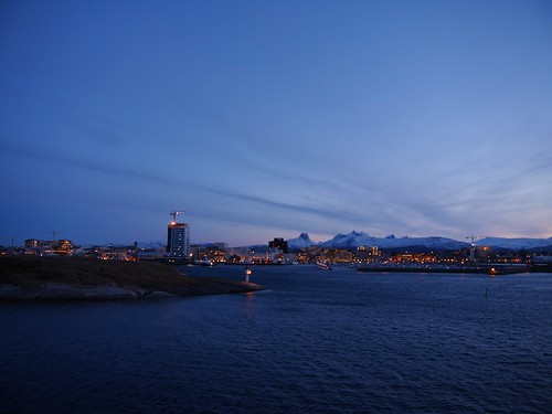
The tour continues and after a stay in the main city of the Nordland county: Bodø we departure on our way to cross the Vestfjorden going to Lofoten.

As you see in a very fine blue hour of the afternoon (3.17PM).

I had done my best to travel this tour under calm sailing conditions (not ordering any tickets before I was reasonably sure of the weather (less than 10 days in front of my tour)).

In this video from the last days you can get an impression of how it can be in the winter time when Hurtigruten departs Bodø in typical winter weather and not the max weather I had:

www.nrk.no/nordland/uvaeret-rammer-fergene-1.11603555


February 28, 2014

Norway Arctic - passing 1 of our 50000 Islands along the coast

 
Tour to North Cape. Day 03 - sailing along the coast north of the Arctic Circle

As compared to the last photo in this series this photo is taken only 1 minutes later in the very fair weather we had this morning in January.
In about an 1 - 2 hrs after this we will arrive Bodø the central town of the Nordland region.
 

February 27, 2014

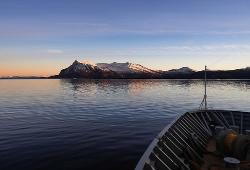
Norway Arctic: Sailing with MS Midnatsol


Tour to Norway, North Cape. Day 03 - MS Midnatsol

We have just crossed the Arctic Circle on our journey up North - on our way to Bodø - the central town in the region of Nordland.
As you can see perfect weather this morning.
 
Some more info of the ship from our coastal express, Hurtigruten:
MS Midnatsol took her maiden voyage along the Norwegian coast in April 2003 and has become a favourite.
The name Midnatsol (Midnight Sun) is something to live up to, and this ship, dedicated to the Norwegian summer, does just that. The interior is bright, its colourful décor is inspired by the warm sunny climate, a motif also reflected in the many pieces of Norwegian modern art on display. MS Midnatsol was put into service on 15 April 2003 and is the fourth Hurtigruten ship to bear this name. The ship has a strong environmental profile and a modern design, with Norwegian matierals used extensively throughout its interiors. Together with her sister ship, MS Trollfjord, MS Midnatsol is among the newest in the fleet. What characterises both ships is the large, two-storey panorama lounge above the bow and the large glass expanses that allow natural light to enter as well as providing extraordinary views. There are also 23 beautifully appointed suites, some of which have a balcony.

Ship description
Year of construction: 2003
Ship yard: Fosen Mekaniske Verksteder, Norway
Passenger capacity: 1000
Beds:638
Car capacity:45
Gross tonnage:16151
Length:135.75
Beam:21.5
Speed:15
 

February 26, 2014

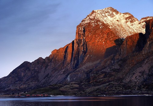
Norway Arctic - the places we live

Tour to North Cape. Day 03 Nordland

We was just crossing the polar circle on our way North and cruising along some of the 50.000 islands we have in our coastal zone.
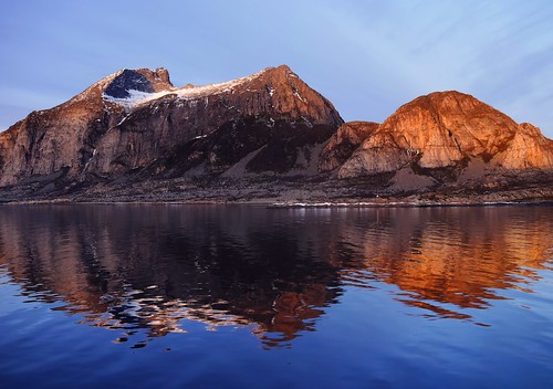
Looking at this mountains, shooting right up of the sea, it is quite common to find a little line of shore with some houses on - a place to live for someone.
Study the details in this photo and you will see that also this island is populated.

February 25, 2014

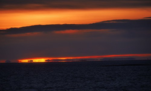
Norway - layered sunset in January


Tour to Norway, North Cape. Day 02 - Layered Fjord Sunset

I left the central town of mid Norway, Trondheim, at noon with the coastal express MS Midnatsol.

I am sailing out the Trondheimsfjorden on my way North. At 3.40 PM the sun is setting partly hidden by some low clouds drifting over the sea out there.

From the net:
The Trondheimsfjord an inlet of the Norwegian Sea, is Norway's third longest fjord at 130 kilometres (81 mi) long. It is located in the west central part of the country, and it stretches from Ørland in west to Steinkjer in north, passing the city of Trondheim on its way.

Its maximum depth is 617 metres (2,024 ft), just inside of Agdenes.
The largest islands in the fjord are Ytterøy and Tautra; the small Munkholmen is located near the harbor of Trondheim; and there are several islands at the entrance of the fjord.

February 24, 2014

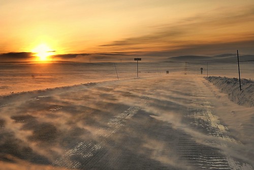
Norway Arctic: Where is the European highway E6?

 
Tour to Norway Arctic. Day 07 - going South along E6 - crossing: Finnmarksvidda

After a great day up at the North Cape the time has come to start my car for the long journey south to Tromsø where a new coastal express is waiting.
 
I have in this photo already passed the long underwater tunnel from Magerøya (where North Cape is situated. The tunnel is 6,875 metres (22,556 ft) long and reaches a depth of 212 metres (696 ft) below the sea level).
I am cruising along the European highway E6 in the outskirt of Finnmarksvidda (Finnmark plateau) in wind of gales force.
 
The snow blowing over the road - almost without traffic - makes it difficult to see the road shoulder. As a Norwegian I have good winter tyres and know to adjust the speed to the existing driving conditions. Better to be a bit delayed - keeping the car on the road, sitting in a warm environment inside, than end up in a ditch sitting in a cold car waiting for assistance....
 
(Suggestion: Have this photo in mind next time you drive along a green marked European Highway E6 :-))
 
My goal this day is the small village Nordreisa some 450km South - where I will visit the farm and the valley of my great grandfather and his family that lived up here 1855-1943.
 
The tour continues....

From wiki about Finnmarsvidda:
Finnmarksvidda English: Finnmark plateau/highland) is Norway's largest plateau, with an area greater than 22,000 square kilometres (8,500 sq mi).
The plateau includes extensive birch woods, pine barrens, bogs and glacially formed lakes. Finnmarksvidda is situated north of the Arctic Circle and is best known as the land of the once nomadic Sami people and their reindeer herds. Their shelters in the tundra, are still in use in winter time.
Kautokeino municipality is Norway's largest by area. Within its borders is the coldest village in continental Norway, Sihcjavri.
Finnmarksvidda, located in the interior of the county has a continental climate with the coldest winter temperatures in Norway: the coldest temperature ever recorded was −51.4 °C (−60.5 °F) in Karasjok on 1 January 1886.

February 23, 2014

Norway Arctic - A Lumix GX7 photo

Tour to Norway, North Cape. Day 04 North of Harstad

As you may have noted I did this tour using my new, mirrorless system camera: Panasonic Lumix GX7.

My 4:3 lens is an Olympus M. Zuiko Digital ED 14-150mm (35mm equal= 28-300mm), F4.05.6. (Why I made a choice for the Olympus lens was purely a price question as the equal Lumix lens was considerably more expensive.

Combined with the fact that the main difference, according to some tests, was that the Panasonic had a lens stabilizer which Olympus did not have. On the other hand the new camera have a camera stabilizer build in the house so no big deal.)

After being a Nikon fan through many DSLR years (even before that with the traditional SLR cameras), and then a short period with Canons top compact camera the Canon G1X, I was very impressed reading some tests on my present Panasonic Lumix GX7 mirrorless system camera (comes even with a super electronic viewfinder) - and ended up with the gear as mentioned above.

As an example of the result you can have right out of the RAW file I present this photo taken in the incredible light in north of the Arctic Circle where the sun in January, in the middle of the dark winter, was rising (under my tour) around 9.30AM and was setting around 2.30PM. Some variations depending on how far north I was at the different days.

Today I present you with a jpg version that is totally without any PP Process from the RAW file - that is except for reformatting from 4592x3448 pixels to 1065x800 pixels (click the photo).

(My usually PP process for the photos used in this series is: Cropping, digital noise removal (ev. Classical soft focus), sharpening and adjustment of levels (or curves) (light and contrast). (But as mentioned in this photo only resizing.)

The photo is taken 9.26AM at sunrise, Jan, 22. 2014. According to my sailing plan with the coastal express we was at that time app. at 68 degrees North (a bit north of Harstad) which we departed 8.00AM).

(Are you in any need to see the full size photo - contact me.).

February 22, 2014

Winter holidays in Norway


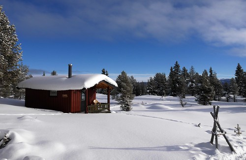
Our small "guest house" was again in use at our mountain place this week as we had some days off for our traditional "winter holiday".

In an alt of 850m we have app 1m of snow, very nice temperature around 0C in the day and superb conditions for cross country skiing.
Have a fine weekend.

February 14, 2014

North Cape, Norway - Children of the World

On Tour to North Cape - day 06 - Finally there III

To be found at the North Cape by the tourist Center: The "Children of the world" sculpture created by Seven children from Thailand to Tanzania.

Here photographed at a visit a grey day in January.

It was strange being almost alone around this great sculpture partly covered in snow in a very low light environment - still with a fading sun in the clouded sky.

And I think this photo version of the sculpture on this day for me was a small highlight as I walked around in solitude at North Cape - outside and inside the big North Cape center.

(BTW the blue in the snow is due to the Arctic low light winter season not any idea, wish or PP from my side :-))

From the net:

The “Children of the World” sculpture was started in 1988 when author Simon Flem Devold randomly selected seven children from seven countries – Tanzania, Brazil, USA, Japan, Thailand, Italy and Russia — to visit the North Cape to dream of “Peace on Earth”.

During their seven day visit, each of the 8-to12-year-old children made a clay relief symbolizing friendship, hope, joy and working together. In 1989 the reliefs were enlarged, case in bronze and erected in a semi-circle outside the North Cape Hall. A “Mother and Child “monument by sculptor Eva Rybakken points toward the seven disks.

February 13, 2014

Tour to North Cape, Norway. Day 06 - finally there II

Almost alone at North Cape - Norway

A special photo of the North Cape cliff a grey day in January. Few visitors only the North Cape globe symbol out there by the steep cliff. This may happen the few days when there is no Northbound coastal express - only a car convoy of 4 cars led by a huge snowplow to and from the main road. Going in at 11AM and out 01.45PM.
 
Believe me - being almost alone at the most Northern point of the European mainland - is for sure a special event.
Nothing else to do then than make a photo of the huge 307m high cliff covered in snow with the globe of iron at the top.
After that going in to the North Cape Center and celebrate with a Pepsi Max to 5 euro in the cafeteria, and pay additional 30 euro for the visit....
 
It took me app. 6 days in all getting there by car and ship (1, 5 day driving and then the coastal express for 3 nights). Distance from my home some 2.100km (1.300 miles). A curiosity: 2.000km further north and we are at the North Pole....
 
History from the net:
The North Cape was named by the English explorer Richard Chancellor in 1553 when he rounded the cape looking for a Northeast passage to East Asia and Pacific America.
After Mr. Chancellor described the cape, some famous people climbed the steep cliff from sea level. The most famous were King Oscar II of Sweden/Norway in 1873 and Thailand's King Chulalongkorn in 1907.
In 1943, the Battle of North Cape was fought in the Arctic Ocean off this cape.
 

February 12, 2014

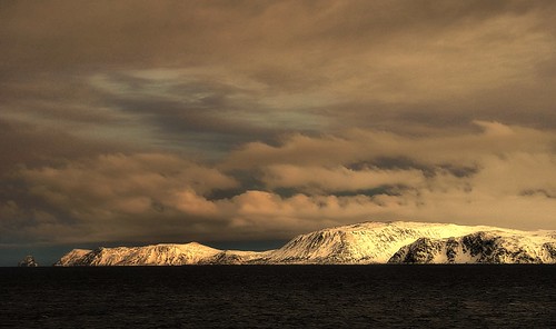
Norway: Arctic landscape - day 05

On the Coastal steamer MS MIdnatsol on tour to my final destination Honningsvaag and North Cape

In the short time between sunrise and sunset the low light present the landscape in a fine way with good details on the clouded day.

Some Norway info from the net:

Norway has a very elongated shape, one of the longest and most rugged coastlines in the world, and some 50,000 islands off the extremely indented coastline. The mainland covers 13° latitude, from 58°N to more than 71°N, (Svalbard north to 81°N), and covers the longitude from 5°E in Solund to 31°E in Vardø (Jan Mayen to 9°W, Kvitøya to 33°E).

Norway is one of the world's most northerly countries, and one of Europe's most mountainous countries with large areas dominated by the Scandinavian Mountains; average elevation is 460 m and 32% of the mainland is located above the tree line.

Virtually the entire country was covered with a thick ice sheet during the last ice age, as well as in many earlier ice ages. The movement of the ice carved out deep valleys, and when the ice melted, the sea filled many of these valleys, creating Norway's famous fjords.

February 11, 2014

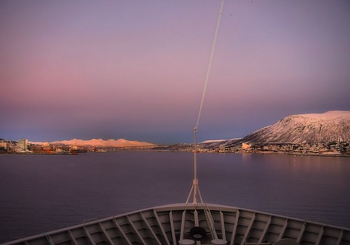
Tour to Norway North Cape. Day 04 - arrival in Tromsoe


Tour to Norway, North Cape. Day 04 Arriving with the Coastal Express MS Midnatsol to Tromsø

The largest town in Norway Arctic is coming up in front of the ship as we, in the artic afternoon light, sails towards the harbour which will be at the left side of the bridge in the far distant. To the right you can see the Arctic Cathedral with the typical white walls.

From the net_
Tromsø city is the ninth-largest urban area in Norway by population, and the seventh largest city in Norway by population. It is the largest city and the largest urban area in Northern Norway, and the second largest city and urban area north of the Arctic Circle (following Murmansk).

Most of Tromsø, including the city centre, is located on the small island of Tromsøya in the county of Troms, 350 kilometres (217 mi) north of the Arctic Circle. Substantial parts of the urban area are also situated on the mainland to the east, and on parts of Kvaløya—a large island to the west. Tromsøya is connected to the mainland by the Tromsø Bridge and the Tromsøysund Tunnel

The city is warmer than most other places located on the same latitude, due to the warming effect of the Gulf Stream.
The city centre of Tromsø contains the highest number of old wooden houses in Northern Norway, the oldest house dating from 1789. The Arctic Cathedral, a modern church from 1965, is probably the most famous landmark in Tromsø.